BEST: multi-scale territorial balance and urban well-being
Université de Technologie de Compiègne · Avenues laboratory (EA 7284) · TN09 final internship
Context
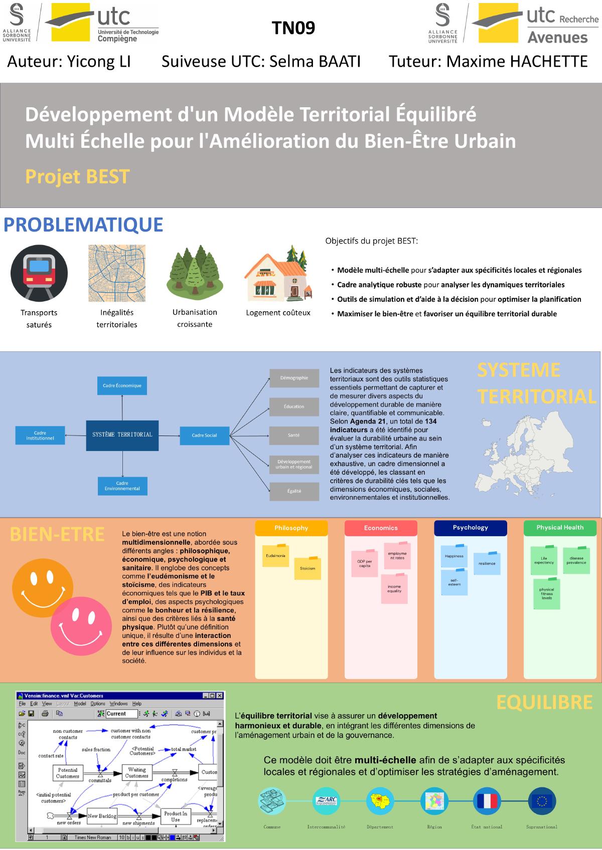
This was my TN09 final internship at UTC’s Avenues laboratory (EA 7284), contributing to BEST — a project building the theoretical foundation for “territorial system balance” and preparing a multi-scale decision-support tool for planners and policymakers.
Growing territories face four tensions: saturated transport, territorial inequality, rapid urbanisation and high housing costs. Existing models (urban dynamics, MCDA, PSR/DPSIR) treat housing, mobility, environment and economy separately; none offers a unified representation of the territorial system.
BEST aims to:
- build a theoretical framework for “balance” applied to territorial systems;
- characterise a dynamic, multi-scale territorial balance whose final criterion is residents’ well-being;
- prepare the conceptual model, indicators and data for a future decision-support tool.
What I did
Three independent systematic reviews, an operationalisation of concepts into indicators, and a quantitative exploration of their relationships.
1. PRISMA systematic reviews
Searched Scopus, Google Scholar, HAL and PROSPERO, mainly in French and English, prioritising the last ten years, and managed references with Zotero.
The protocol followed PRISMA: identify studies → remove duplicates → screen titles and abstracts → full-text reading and inclusion criteria. Each article was classified as relevant / partially relevant / not relevant, with a justification.
| Theme | Articles analysed | Guiding question |
|---|---|---|
| Territorial system | 360 | How is a territory organised, and at which scales? |
| Well-being | 120 | Which dimensions make up residents’ well-being? |
| Territorial balance | 80 | Which levers support harmonious development? |
| Total | 560 |
2. Indicator frameworks
- Territorial system: the 134 urban sustainability indicators of Agenda 21, classified by economic, social, environmental and institutional dimensions, supplemented with French sources (INSEE, ADEME, eaufrance, ATMO France, ministries).
- Well-being: the 11 dimensions of the OECD Better Life Index — housing, income, jobs, community, education, environment, civic engagement, health, life satisfaction, safety, work-life balance — distinguishing objective (homicide rate) and subjective (feeling safe walking alone at night) indicators.
Each row documents the definition, official source and calculation method, so the indicators can be implemented directly.
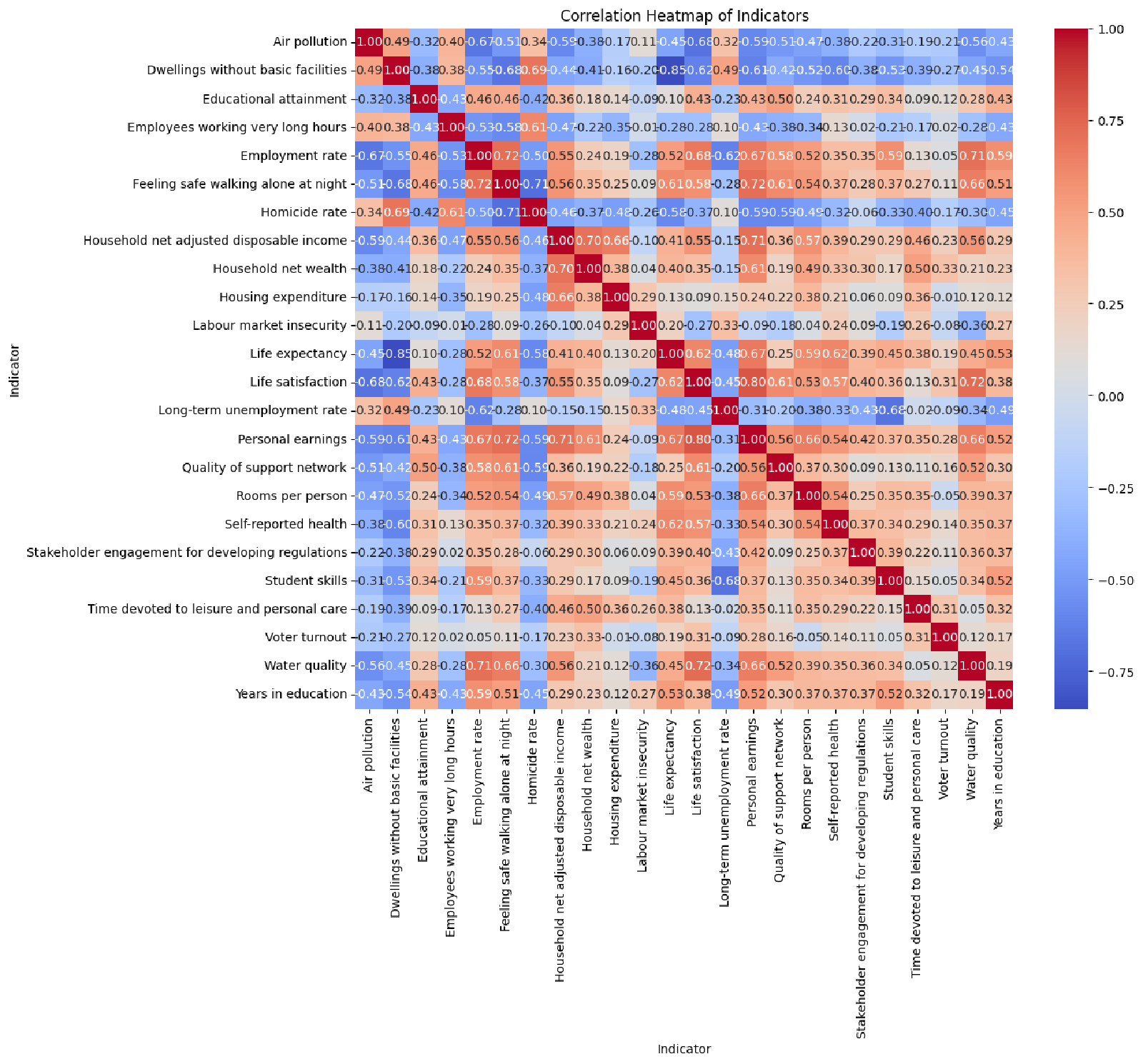
3. Correlation analysis
The goal was to check the internal consistency of the indicator set and identify dependencies to include in the model.
OECD CSV (long format) → pivot country × indicator → Pearson matrix
                        → seaborn heatmaps → comparison by country group
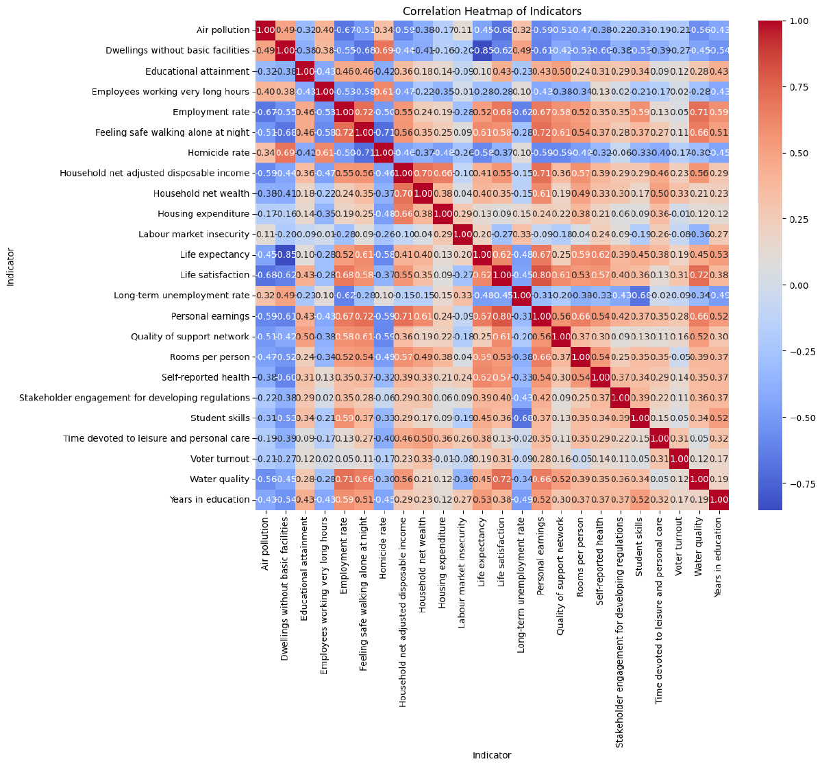
Representative relationships:
| Relationship | r | Reading |
|---|---|---|
| Life expectancy ↔ dwellings without basic facilities | −0.85 | Poor sanitation undermines health |
| Personal earnings ↔ life satisfaction | +0.80 | Perceived well-being is strongly linked to financial stability |
| Unemployment rate ↔ student skills | −0.68 | Qualification and employability are linked |
One anomaly was kept: water quality correlates strongly with employment and life satisfaction. It is more likely a sample-structure effect than a causal mechanism, and needs explanation in later modelling.
4. Conceptual modelling
Combined Forrester’s urban dynamics (population / housing / economic activity and feedback loops), MCDA, PSR / DPSIR and a sensitivity model into a multi-scale framework.
Tools: Vensim (system dynamics), ArcGIS (spatial analysis and mapping), Python (indicator processing), Excel (indicator tables).
Results
- A structured corpus of 560 articles and three conceptual reviews defining territorial systems, well-being and balance, and their links.
- Two ready-to-use indicator frameworks with official sources and formulas, providing the quantitative base for the future tool.
- A reproducible correlation analysis (code, data, figures) showing that most Better Life Index relationships match expectations, while isolating anomalies.
- A contribution to the BEST conceptual framework and decision-support algorithm.
Limits
- The corpus is mainly English; French literature was used complementarily, not systematically.
- Correlation is not causation: the analysis is exploratory, without significance testing or control for confounders.
- Missing values were filled with
0following the original analysis, which may bias some correlations for incomplete countries. - Indicator units, scales and periods remain heterogeneous; aggregating them into a single index was not the task of this internship.
Links
- Research code and public material: https://github.com/yicongl1/TN09-BEST-Territorial-Well-Being
- Academic record: /en/undergraduate/utc/#course-TN09
Public files
Technical notes
Related skills
- Zotero
- ArcGIS
- Academic writing
- Project management